Torrential rains are drenching California, flooding streets across the state. Is this normal? UC Berkeley geologist B. Lynn Ingram says that California faces megafloods about once every 200 years, but climate change will make dangerous floods more frequent. Here, Ingram explains how it works. This interview has been edited for length and clarity.
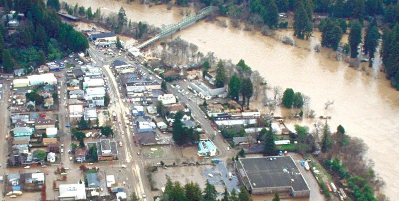
In the 20th century there might have been five to ten large “atmospheric river” storms like we’re seeing now in California, storms with major flooding.
On a longer time scale, there was a much bigger storm in the 1800s — that megaflood was a similar event, but it lasted 43 days. It started on Christmas Eve and continued until early February, and it completely overwhelmed the state.
California went bankrupt, and the whole Central Valley was under some 10 feet of water. They called it the Big Inland Sea — 300 miles long and 20 miles wide. The capital, Sacramento, was under water. People were in rowboats, and the legislature had to move to San Francisco.
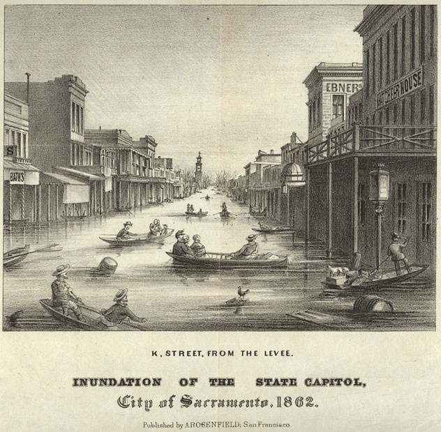
If we go back even further in time into the geologic record — using sediment cores from flood plains, bays or the ocean coasts — we can see thick flood layers produced by other big storms, with an 1861-type flood, or larger, occurring about every 200 years. The 1861 flood wasn’t a freak event. Just like with our big earthquakes, megafloods occur every one to two centuries.
To reconstruct past weather and climate, researchers calibrate using indicators in modern sediments, then look at sediment cores to see back in time and measure the same indicators for past climate. Layered sediments from the coastal ocean go back more than 100,000 years.
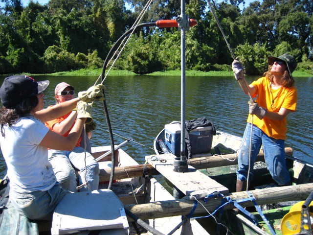
With tree rings there are different growth seasons. So during the growing season, a layer looks one way. During wintertime, it looks another way, and you see this pattern repeating. Similar patters can be seen in some sediments in lakes and the coastal ocean, where the differences we see in layers are usually seasonal changes.
My colleagues and I are seeing seasonal changes in cores from off Santa Barbara, in the coastal ocean. During the spring and summer, upwelling of nutrient-rich waters causes a lot of phytoplankton to reproduce very quickly, and when they die, their skeletons settle on the seafloor and form a whitish layer. During the wintertime, the phytoplankton aren’t reproducing as much, but you get rain and runoff from the land, and you’ll get a darker layer that’s produced from sediments carried in by rivers. That pattern just keeps repeating.
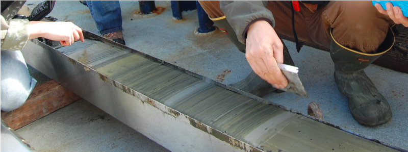
With 100 years of calibration, the model is pretty robust, and you can tell what annual layers look like. And we can see some of the big floods. Every 200 years or so you’ll see a really thick layer of sediment — one to two centimeters instead of a few millimeters — material that’s rapidly eroded from the surrounding mountains and watershed. We then compare our records with other records to identify similarities and differences, particularly in relation to regional patterns.
Climate models, such as those led by Michael Dettinger at the U.S. Geological Survey, are seeing more, and bigger atmospheric river storms in the future. Those storms originate in the tropics and they’re like an escape valve for all the extra energy and water vapor in the atmosphere there — narrow bands of moisture that travel across the Pacific and end up on the U.S. west coast.
A warmer atmosphere can hold more vapor, so such models show the storms will get larger, and there will be more of them. And there’s a higher potential for even bigger ones.
Our climate in California is one of the most variable in the country. In the paleoclimate records, you see this alternation between dry, multi-year droughts and then floods and wetter periods. You see cycles like the 200-year cycle, or the Pacific Decadal Oscillation and El Niño cycles.
If you go back in time during warmer periods, such as the Medieval warm period, there was drought in California — on average 30 percent drier for more than a century. Within those droughts were megafloods. So even in the midst of a drought, the weather can be punctuated by these really big storms.
That’s what models are predicting for the future. On average, it’s going to be drier in California, even if precipitation goes up. Because it’s warmer, you’re going to have more evaporation and drying of soils, and snowpack is going to be declining because more precipitation will be falling as rain than as snow. There will be overall drying, interspersed with larger and more frequent atmospheric river storms fueled by increasing evaporation in the tropics. We’re going to see more extremes of wet and dry.
As the climate warms, I’m definitely concerned about what might come next. California has been growing in places, like the Central Valley and the Delta. Parts of the Delta are below sea level because it has been sinking. The Central Valley has also been sinking because of groundwater pumping, and some parts are 30 feet deeper than in 1861. It’s so much worse now — there are more than 6 million people living in the Central Valley alone.
In 2011 the USGS presented the ARkStorm [Atmospheric River 1,000 Storm] scenario to model the impacts of an 1861-type storm, at the time thought to be a 1,000-year event. They modeled the storm with today’s geography and where people are living. The bottom line is damage totaled more than $700 billion.
ARkStorm only modeled 23 days of solid rain, instead of the 1861 storm’s 43 days. The Central Valley would be underwater. There would be almost 2 million evacuations and thousands of deaths if there was no warning system or preparations like we now have for earthquakes.
Everyone knows about our big earthquakes, and everyone has their kits, and people know what to do. But there isn’t the same awareness, at all, with these kinds of floods. The awareness needs to come out. These stories and messages need to get out there.
B. Lynn Ingram is a professor of earth and planetary science at the University of California at Berkeley and co-author of The West Without Water. This interview was conducted by Josh Chamot, who writes for Nexus Media, a syndicated newswire covering climate, energy, policy, art and culture.